Exploration Camping Trip on the Lower Trinity River

The Story
Trinity Coalition members joined members of the Dallas Downriver Club on a three day paddling trip to explore the Lower Trinity River Below Lake Livingston.
The Trinity River is a 710 mile (680 kilometers) long river in Texas and is the longest river with a watershed entirely within a single state (Wikipedia). Many of us have paddled the Clear Fork, the West Fork, the Elm Fork and even the main branch of the Trinity River in the DFW area. However, between Dallas and Lake Livingston there are very few river access points. Below Lake Livingston there are more access locations, including some TPWD boat ramps.
Given the easy access locations on the lower Trinity River below Lake Livingston I decided to explore this part of the Trinity River. I first visited the lower Trinity in May 2021 driving up from Houston to Lake Livingston and visiting all the river access locations along the way. Here is a simple breakdown of the lower Trinity Access locations, starting just below the Lake Livingston Dam.
Location | Type | Mile |
FM-3278 | Boat Ramp | 0 |
Hwy-59 | Boat Ramp | 9.5 |
Hwy-787 | Steep Trail/Path (30 yards / difficult) | 30 |
Hwy-105 | Dirt Rd. to a Sand Bar (heavily used) | 51 |
Hwy-90 | Boat Ramp | 70 |
Rt-10 | Boat Ramp | 95 |
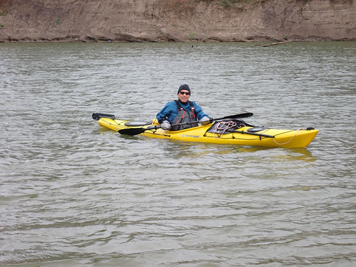
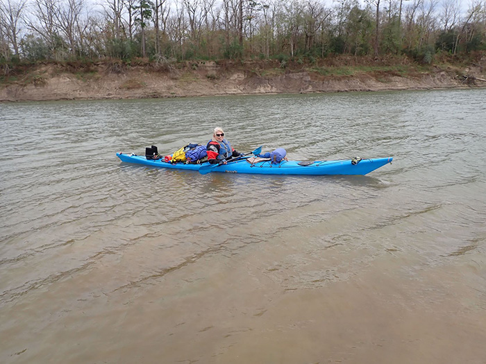
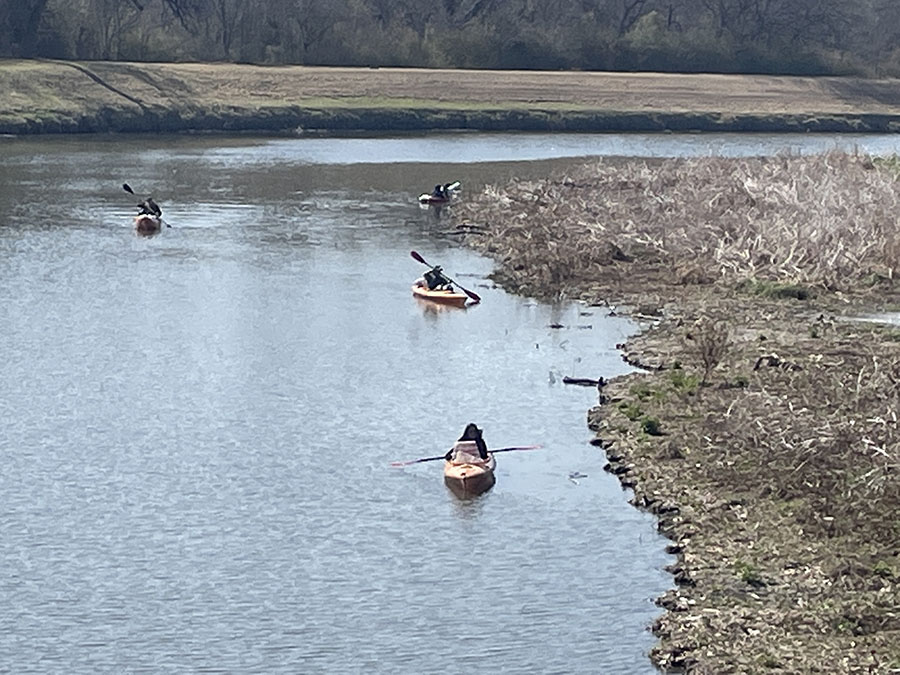
The lower Trinity is a wide river at 100+ yards. This is important because paddlers are impacted by the wind on wide rivers. The banks are very steep, so in high water conditions the river does not get much wider only deeper. Most of the year the river has numerous sand bars to camp and rest on. The color of the water is the same light green that we typically see on the Trinity in the DFW area.
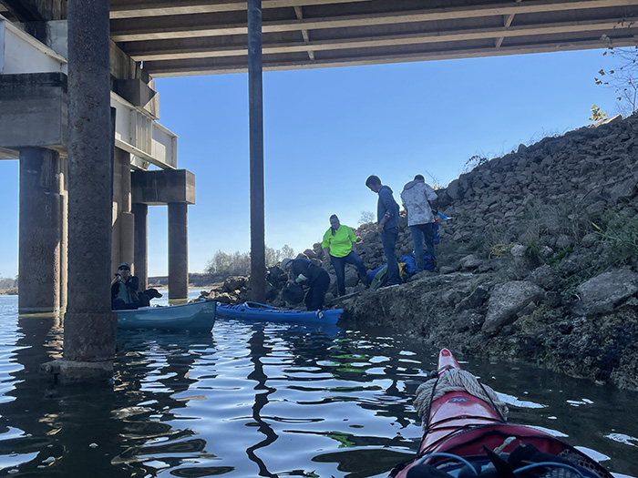
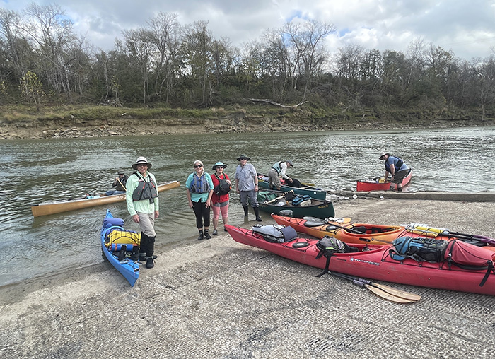
On December 10th, 8 of us paddled and camped on the lower Trinity River from Hwy-59 to Hwy-787, a distance of 21 miles We met on Friday morning at 10:30 am at the Hwy-59 boat ramp, a large, wide, and very steep public ramp. As we unloaded boats, Jennifer, our shuttle driver from Lake Livingston Kayaks, arrived to meet us and make the arrangements to drive Bryan’s truck and trailer and meet us at the take-out on Sunday the 12th.
Based on Texas river gauge # 08066250 (Trinity Rv nr Goodrich, TX) https://waterdata.usgs.gov/tx/nwis/uv/?site_no=08066250&PARAmeter_cd=00065,00060 the river flow was 1,200 (+/-). This is considered very low by the locals.
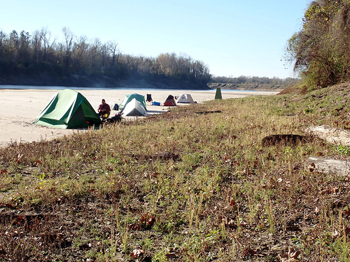
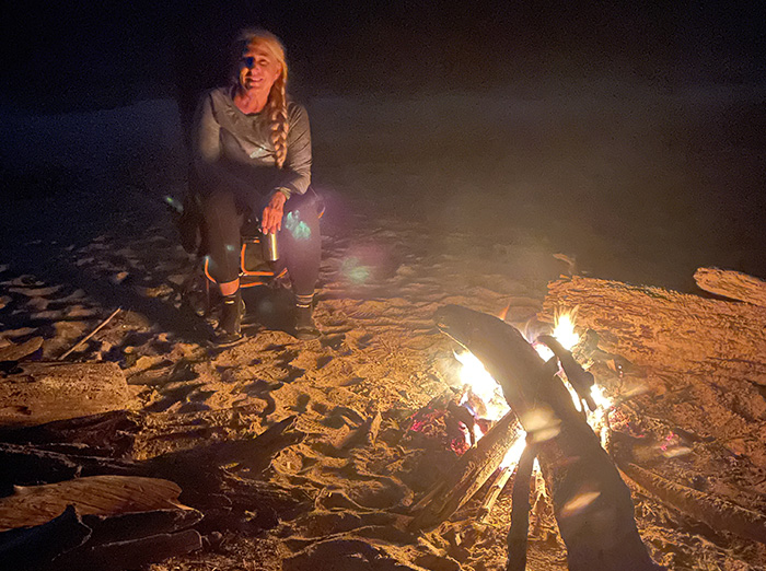
As expected, the wind was directly in our faces as we started downriver. If I remember correctly, it was 10 to 15mph with gusts up to 25mph, which made for a slow day paddling. Our goal was ~6 miles the first day, but it was 7.5 miles before we found a sand bar suitable for camping. We all knew going into this trip there was a very high probability of rain early Saturday morning, so we all prepared for it. The storm blew through about 3:30 am, with winds screaming through the trees for several minutes before the storm actually hit us. After a brief hard rain lasting 20 or so minutes, the storm ended. But it brought a cold front with it. By Sunday morning official temperatures for the area hovered in the mid-30’s, which meant low 30’s on the river. Again we were all prepared and everyone stayed warm though the night. One of the canoes had been tied down facing cockpit into the wind and we awakened to find that boat had been blown off its tie down and was 50 yards down the sandbar from where it had been staked. Fortunately it was not blown into the river.
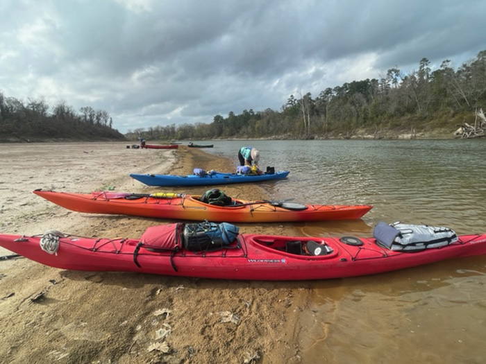
On Saturday our goal was to paddle 12 miles, which we did. The wind was to our backs most of the day. That that put us about 1.5 miles from the take-out by the time we found a location suitable for camping. We had to pass up some really nice sand bars because there were houses along the bank and we really didn’t want to camp in someones backyard. We found out the next morning that there were only 2 sand bars left before the take-out. As I was approaching the last bend in the river before the take-out I got bumped hard by something – it lifted my canoe slightly. I assumed it was a large gar – they can get several feet in length.
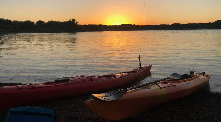
The sand bars along this section of the lower Trinity are not very high up off of the water and they were relatively flat which made easy camping. For the most part the sand bars we camped on were very long and wide. We avoided sandbars that had lots of ATV tracks.
I warned everyone that the take-out at Hwy-787 was nothing more than a goat trail. But the river was so low that it was a little worse than expected. The river was actually a few feet below the goat trail. We had targeted noon for our shuttle driver, but since we were only 1.5 miles upstream we arrived at the take-out at 11am. Fortunately our shuttle driver, Jenifer, must have been clairvoyant because she actually showed up early with 3 teenagers, think sherpas, who helped pack us up the goat trail to the vehicles. It was greatly appreciated.
In summary, the lower section of the Trinity is wide and susceptible to high winds – I think a touring canoe or kayak is the best boat for these conditions. I really didn’t see any good trees for hammocks other than far back from the river in the heavily wooded areas, so cots or tents and pads would be the preferred sleeping platform. We saw signs of wild pigs and deer, but did not actually see any large animals other than cattle. There was enough driftwood for good campfires both nights without having to range too far to collect it. All in all a fun adventure on a distant part of the Trinity that may one day become a part of our paddle trail.
-
Trip Date:
Dec 10, 2021
-
Submitted by:
Teresa Patterson
-
Put In Location:
Hwy 59 Bridge and Trinity River South of Lake Livingston
-
Take Out Location:
Hwy 787
-
River Flow:
1200cfs (approx.)
-
Weather:
Learn More
Upcoming Events
There are no upcoming events.